UPDATE: Latest Northeast Iowa River Levels

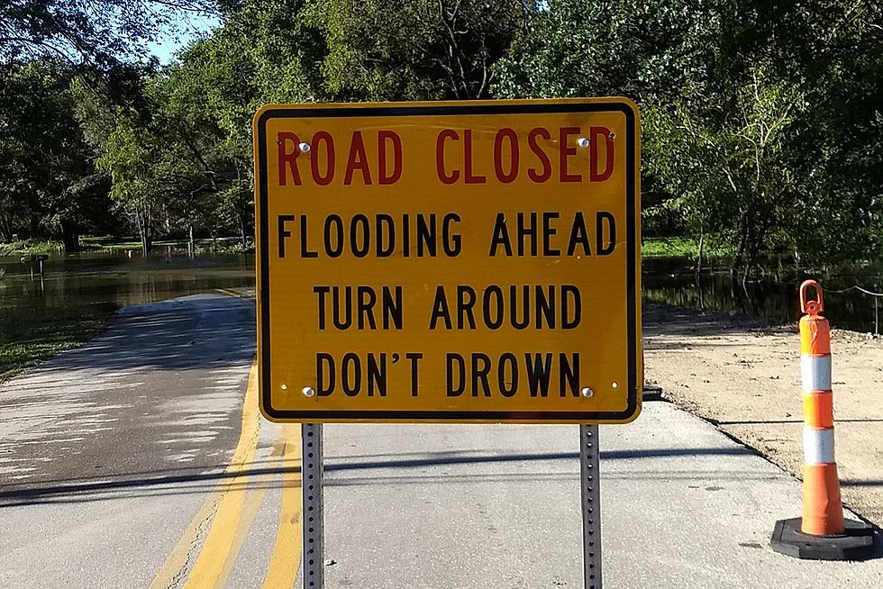
Heavy rainfall in northeast Iowa last last week has resulted in widespread flooding for parts of the region.
Rivers in some areas have crested, while they continue to rise in other areas. Flood warnings remain in effect for the Turkey River at Elkader and Garber, for the Wapsipinicon River at Independence, and the Cedar River at Janesville downstream to Waterloo.
National Weather Service officials said the Turkey River at Elkader crested Monday at 22.8 feet, more than 10-feet above its 12-foot flood stage. The crest was the fourth-highest on record. The river is expected was expect to fall below flood stage early Tuesday. Minor flooding is occurring.
Moderate flooding is occurring along the Turkey River downstream at Garber. The river crested at Monday at 23.4 feet, just over six feet above its 17-foot stage. At 3:15 AM Tuesday, the river stage was at 21.2 feet and falling.
The Wapsipinicon River threatening to overrun its banks at Independence, where major flooding is forecast. The river is expected to rise quickly Tuesday and crest at 16.3 feet around midnight Tuesday. That level would be just over four feet above the 12-foot flood stage and would affect homes and businesses.
At 2:30 AM Tuesday, the Wapsipinicon River at Independence was at 7.2 feet, well below flood stage. Upstream at Tripoli, the river level Monday hit a near-record high.
The Cedar River is rising in Cedar Falls and Waterloo, but isn’t expected to cause much flood damage. The river crested at 15 feet in Janesville Monday, two feet above the 13 foot flood stage.
Moderate flooding is forecast in Cedar Falls, where the river is expected to crest at 92.4 feet Tuesday morning. That's just over four feet above the 89-foot flood stage. NWS officials believe the Cedar will crest at around 14.2 feet in Waterloo this evening, about one foot above flood stage.
The swollen Cedar River could force some campers to change their holiday plans. Just days before the long Labor Day weekend, flooding has indefinitely closed two of the Cedar Valley's most-popular campgrounds: George Wyth State Park in Waterloo and Black Hawk Park near Cedar Falls.
Here are the latest flood warnings from the National Weather Service:
Cedar River at Cedar Falls
* Until early Thursday afternoon.
* At 1:45 AM CDT Tuesday the stage was 91.3 feet and rising.
* Flood stage is 89.0 feet.
* Minor flooding is occurring and moderate flooding is forecast.
* Recent Activity...The maximum river stage in the 24 hours ending at 1:45 AM CDT Tuesday was 91.3 feet.
* Forecast...The river is expected to rise to a crest of 92.4 feet Tuesday morning. It will then fall below flood stage early Wednesday afternoon.
Cedar River at Waterloo
* Until early Thursday morning.
* At 2:00 AM CDT Tuesday the stage was 11.8 feet and rising.
* Flood stage is 13.0 feet.
* Minor flooding is forecast.
* Forecast...The river is expected to rise above flood stage early Tuesday morning to crest of 14.2 feet Tuesday evening. It will then fall below flood stage late Tuesday night.
Cedar River at Janesville
* Until Wednesday morning.
* At 1:45 AM CDT Tuesday the stage was 14.3 feet and falling.
* Flood stage is 13.0 feet.
* Minor flooding is occurring and minor flooding is forecast.
* Recent Activity...The maximum river stage in the 24 hours ending at 1:45 AM CDT Tuesday was 15.0 feet.
* Forecast...The river is expected to fall below flood stage Tuesday morning and continue falling to 3.0 feet Tuesday evening.
Wapsipinicon River at Independence
* From this morning to Friday afternoon.
* At 2:30 AM CDT Tuesday the stage was 7.2 feet.
* Flood stage is 12.0 feet.
* Major flooding is forecast.
* Forecast...The river is expected to rise above flood stage late Tuesday morning to a crest of 16.3 feet just after midnight Tuesday. It will then fall below flood stage late Thursday evening.
Turkey River at Elkader
* Until late Tuesday evening.
* At 3:45 AM CDT Tuesday the stage was 12.7 feet.
* Flood stage is 12.0 feet.
* Minor flooding is occurring.
* Recent Activity...The maximum river stage in the 24 hours ending at 3:45 AM CDT Tuesday was 22.8 feet.
* Forecast...The river is expected to fall below flood stage early Tuesday morning and continue falling to 6.2 feet next Monday evening.
Turkey River at Garber
* Until late Wednesday morning.
* At 3:15 AM CDT Tuesday the stage was 21.2 feet.
* Flood stage is 17.0 feet.
* Moderate flooding is occurring and minor flooding is forecast.
* Recent Activity...The maximum river stage in the 24 hours ending at 3:15 AM CDT Tuesday was 23.4 feet.
* Forecast...The river is expected to fall below flood stage late Tuesday afternoon and continue falling to 6.7 feet next Monday evening.
KEEP READING: Get answers to 51 of the most frequently asked weather questions...
LOOK: Here are the 25 best places to live in Iowa
More From Q98.5

![These Are The Best Reviewed Distilleries In Eastern Iowa [PHOTOS]](http://townsquare.media/site/724/files/2024/06/attachment-Untitled-design2.jpg?w=980&q=75)