![Flood Warnings Posted For Several Northeast Iowa Rivers [PHOTOS]](https://townsquare.media/site/725/files/2021/08/attachment-waucoma-6.jpg?w=980&q=75)
Flood Warnings Posted For Several Northeast Iowa Rivers [PHOTOS]
Some northeast Iowa rivers are on the rise after strong storms dumped torrential rain across region and spawned at least two tornadoes.
Clean-up continues in southern Floyd County, where at least two tornadoes touched down near Marble Rock Friday night.
National Weather Service officials said the first tornado damaged crops and outbuilding roof on a local farm. They surveyed the damage over the weekend and rated the twister an EF0, with estimated peak winds of 75 MPH. The tornado touched down at 5:51 PM and was on the ground for about two minutes. It was 45 yards wide and left a path of destruction for about one mile.
The second tornado hit just west of Marble Rock just before 6 PM and crossed to the south and southeast of town, destroying nearly every building on one farm. NWS officials said several other farms and rural homes were damaged, along with crops and trees.
A survey team rated the second tornado an EF1, with peak wind speeds estimated at 105 MPH. The twister had a maximum width of 135 yards and was on the ground for about 3.2 miles.
Storm damage was also reported near the towns of Calmar and Monona, but no injuries were reported with Friday's storms.
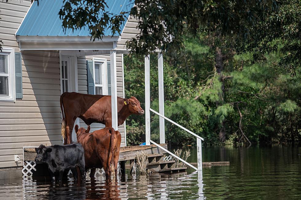
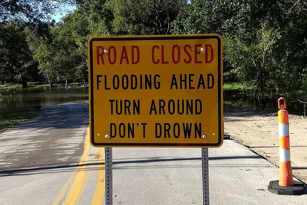
National Weather Service officials said rainfall of 3 to 8 inches also led to significant flooding in northeast Iowa. Several rivers went over their banks, which led to the closure of many area highways. Flood water covered Iowa Highway 18 near Fredericksburg and New Hampton. Local emergency management officials reported secondary roads being damaged or washed out and several homes were flooded.
Flood warnings continued for the following northeast Iowa rivers on Monday:
Wapsipinicon River at Independence.
* From late Monday to early Friday afternoon.
* At 9:30 AM CDT Monday the stage was 6.3 feet.
* Flood stage is 12.0 feet.
* Major flooding is forecast.
* Forecast...The river is expected to rise above flood stage Tuesday just
after midnight to a crest of 16.7 feet early Tuesday
afternoon. It will then fall below flood stage Thursday evening.
Cedar River at Charles City.
* Until Tuesday morning just after midnight.
* At 2:30 AM CDT Monday the stage was 13.2 feet.
* Flood stage is 12.0 feet.
* Minor flooding is occurring and minor flooding is forecast.
* Forecast...The river is expected to fall below flood stage Monday
and continue falling to 3.7 feet Sunday evening.
Cedar River at Janesville.
* From Monday morning to Wednesday morning.
* At 6:45 AM CDT Monday the stage was 14.7 feet and rising.
* Flood stage is 13.0 feet.
* Minor flooding is occurring and moderate flooding is forecast.
* Recent Activity...The maximum river stage in the 24 hours ending
at 6:45 AM CDT Monday was 14.7 feet.
* Forecast...The river is expected to rise to a crest of 15.4 feet
Monday evening. It will then fall below flood stage Tuesday morning.
Cedar River at Cedar Falls.
* From Monday morning to early Thursday morning.
* At 6:45 AM CDT Monday the stage was 87.5 feet and rising.
* Flood stage is 89.0 feet.
* Minor flooding is forecast.
* Forecast...The river is expected to rise above flood stage late
Monday morning to a crest of 91.6 feet tomorrow morning. It will
then fall below flood stage early Wednesday morning.
Turkey River at Garber.
* Until early Wednesday afternoon.
* At 3:15 AM CDT Monday the stage was 20.0 feet.
* Flood stage is 17.0 feet.
* Minor flooding is occurring and major flooding is forecast.
* Forecast...The river is expected to rise to a crest of 25.0 feet
Monday evening. It will then fall below flood stage Tuesday evening.
Turkey River at Elkader.
* Until late Wednesday evening.
* At 2:45 AM CDT Monday the stage was 20.9 feet.
* Flood stage is 12.0 feet.
* Major flooding is occurring and major flooding is forecast.
* Forecast...The river is expected to rise to a crest of 24.0 feet
Monday afternoon. It will then fall below flood stage early
Wednesday morning.
Upper Iowa River at State Highway 76 in Dorchester.
* From Monday morning to late Tuesday evening.
* At 2:00 AM CDT Monday the stage was 13.4 feet.
* Flood stage is 14.0 feet.
* Minor flooding is forecast.
* Forecast...The river is expected to rise above flood stage late
Monday morning to a crest of 14.8 feet Monday evening. It will then
fall below flood stage late Monday.
Northeast Iowa Flooding: August 2021
KEEP READING: What to do after a tornado strikes
More From Q98.5